Geology

Definitions and images to illustrate geological terms, links to images and website articles

M

magmatic differentiationmagmatic mixingmappingmélangemineralsmonoclines

◊◊◊ Minerals Index ◊◊◊

| 0 Guide-Glossary

magmatic differentiation

Magmatic differentiation is a complex process whereby a single melt can produce a wide variety of different igneous rocks. Some degree of differentiation typically develops across space and time in exposed magma bodies (intrusive or extrusive).

Most melts develop in the lower crust or in the asthenosphere (upper mantle), so, such melts have a primitive mafic or basaltic composition, whereas melts developing in the upper crust have a higher initial silica content.

Regardless of depth of formation, melts ultimately produce igneous rocks that depend on the composition of the original melt, on the properties of wall rocks encountered during ascent, and on rate/s of cooling. The main processes involved in differentiation are assimiliation, exchange of volatiles, fractional crystallization, and magmatic mixing.

Bowen's Reaction Series

[links: animations: fractional crystallization/magmatic settling]

Labels: , , , , ,

| 0 Guide-Glossary

magmatic mixing

Magmatic mixing in areas of active magmatism is the process wherby adjacent magma bodies can develop transient subsurface communications before their eruption or final subsurface emplacement.

Anatexis-related magmatic mixing involves the secondary melting of mid- to lower crustal rocks upon contact with much hotter, rising mafic melts of mantle origin, and produces felsic (feldspar- and quartz-rich) magmas in arc and continental rift settings. Such melts may reach high crustal levels carrying both mantle heat and mantle material.

Labels: , ,

| 0 Guide-Glossary

mapping

A geological map provides a graphic representation of selected geological features within a desired surface topographic or subsurface area. The size and relative position of each feature on the map corresponds to its correct geographic situation according to an established scale and projection. When mapping out a region, standardized terms are employed to describe the spatial orientation (attitude) of planar and linear elements of folds, faults, and other geological structures (diagram):

. The strike of a plane is the compass direction of the line formed by the intersection of the horizontal plane with the inclined plane under consideration. So, strike marks the geographical direction perpendicular to dip. ├ Strike and dip are depicted on geological maps by a long line (strike) with a short perpendicular line (dip) and a number indicating the angle of dip (degrees).

In North Amercia, strike is often expressed as the angle E or W of true North (0º-90º). In the European system, compass directions are expressed as azimuths. The azimuth is measured clockwise along an horizontal plane from the true North direction to the strike line (0º-359º). N=0º, E=90º, S=180º, W=270º.

A strike tending 26º east of true north would be expressed as N26ºE in Canada and the US, and as 026º in the European system. Similarly 74º west of true north would be expressed as N74ºW in the North American system, and as (360-74=) 286º in the European system.

.. The dip of a plane is analogous to plunge, and is the angle in degrees measured from an horizontal plane down to the inclined plane under consideration. That is, dip is the angle between the inclined plane and the horizontal plane, and is measured along a vertical plane perpendicular to the strike line of the plane.

Strike and dip directions of a fold are always mutually perpendicular, though two planes could have the same numerical strike (direction) and dip (angle). That is, a plane inclined at 45º to the horizontal (dip) that is facing SSE (135º) could have a strike (direction) of 45º East (o45º).

Strike and dip are differentiated in North America by expressing the direction according to the geographic quadrant faced by the planes. By European convention, strike is expressed as a three digit azimuthal number, and dip as a two digit angular number. Thus, a plane striking 25º and dipping 45º toward the southwest would be noted: 025-45SW.

Labels: , , , , , , , , ,

| 0 Guide-Glossary

mélange

3D image looking down on Point Bonita, CA - part of the Franciscan mélange - a mix of late Mesozoic metabasalts, sandstone, and conglomerates. Courtesy USGS A mélange is a mappable-sized, breccia containing varied rocks jumbled together with little continuity of contacts. The diverse blocks within a mélange are supported and separated by a matrix of fine grained material (typically shale, slate, or serpentinite) with a tectonic fabric. Mélanges originate either as components of tectonic accretionary prisms, as a result of gravitational submarine sliding (olistostromes), or through diapirism (diagram).

An olistostrome, or "gravitational mélange", is a mappable, chaotic sedimentary deposit composed of heterogeneous olistoliths (blocks) derived from submarine gravity siliding or slumping of unconsolidated sediments. Such slides may have traveled several dozen to several hundred kilometers, resulting in large, thick, heterogeneous stratiform units that accumulated somewhat chaotically from an active fault escarpment, in various tectonic settings.

Olistostromes may range from several meters up to several hundreds of meters thick, and component olistoliths (blocks)may have preserved their internal coherence to the extent that the original facies can still be established. Olistoliths are immersed in a fine-grained matrix (typically mudstone or serpentinite).

Olistostromes are mélanges formed by semi-fluid accumulation of submarine, gravitational flow. Slide masses composed of hard rocks plus semi-indurated and soft sediments fail when the softer and friable materials form a basal mobile phase. Such a slide may even have liquefied and progressively disintegrated during displacement. So, olistostromes are stratigraphic units with chaotic bedding or without true bedding, yet which are intercalated between normal sedimentary bedding sequences.

[links: images: formations: mélanges: tectonic mélange rocks; melange enclosed in dark matrix of serpentinite and containing a block of S-type, coarse granite, eastern flank of the Cordillera Occidental; a 
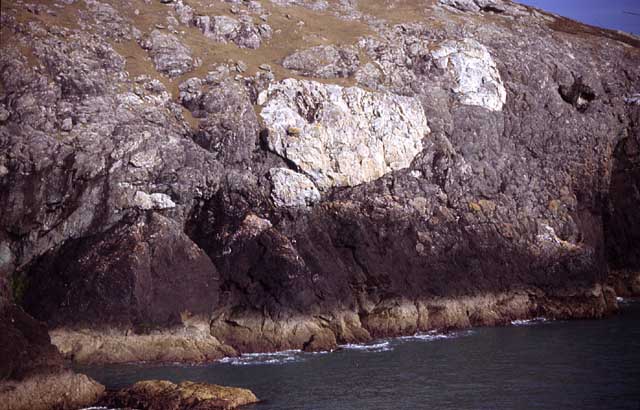
mélange is a mappable body of rock that includes fragments and blocks of all sizes, embedded in a generally sheared matrix; Franciscan mélange, another, Central Valley; 
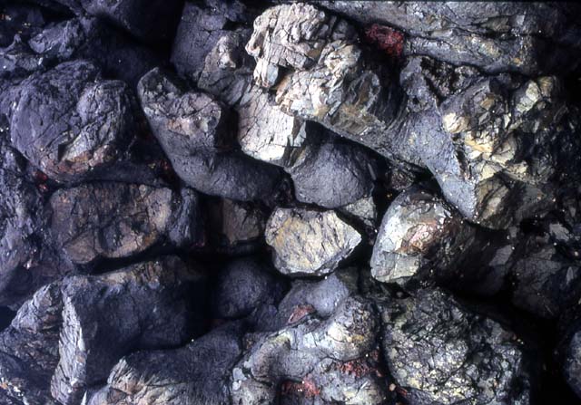
Franciscan mélange - isolated blocks of resistant Franciscan rocks of various types (known as knockers) mixed into a sheared mudstone matrix;
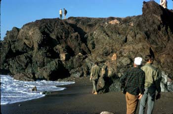
 3D of Point Bonita, Kirby Cove; mélange, Marin headlands, another, and 
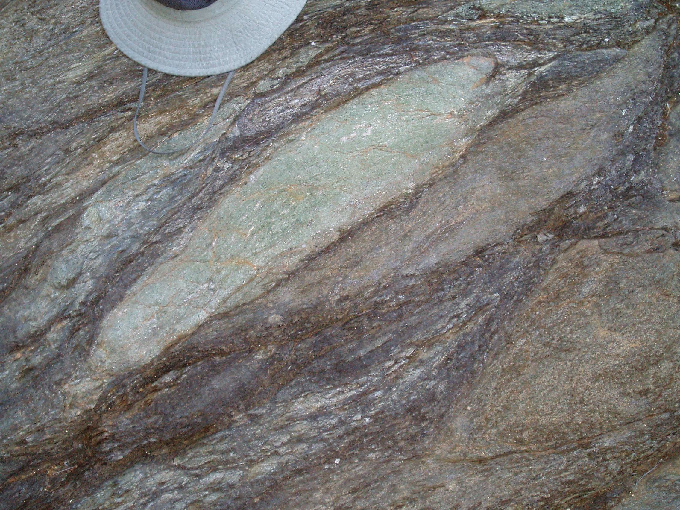
close-up of mélange with chert clasts; close-up of disarticulated Hartland granofels block in a tectonic mélange near Cameron’s Line; mélange close-up; close-up of fragment of greenstone in mud-rich mélange, Malua Bay, south of Batemans Bay, south coast of New South Wales, fragments of sandstone in mud-rich mélange, Garden Bay, near Malua Bay, small fragments in mud-rich mélange, Sunshine Bay, south of Batemans Bay, chert mélange from the southern side of Burrewarra Point, south of Batemans Bay; exotic breccia blocks, eroded from the Hoh mélange, near Goodman Creek, 2; mélange, Kiryu-Kurohone Complex, Japan; tectonic mélange at the base of a large thrust sheet of Bravo Lake volcanic rocks; quartzite blocks in Gwna Mélange, Llyn Peninsula and Anglesey, Wales, and pillow-basalts, Porth Dinllaen ; Dunnage Mélange near Gander, Newfoundland; mélange, Nfld; Cretaceous rock in mélange in CA; thrust fault composed of imbricated structure, coherent and mélange facies, shear fabrics, Japan; amphibolite-grade mélange in Catalina Schist; olistrosomes: olistrosome; 
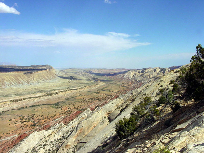
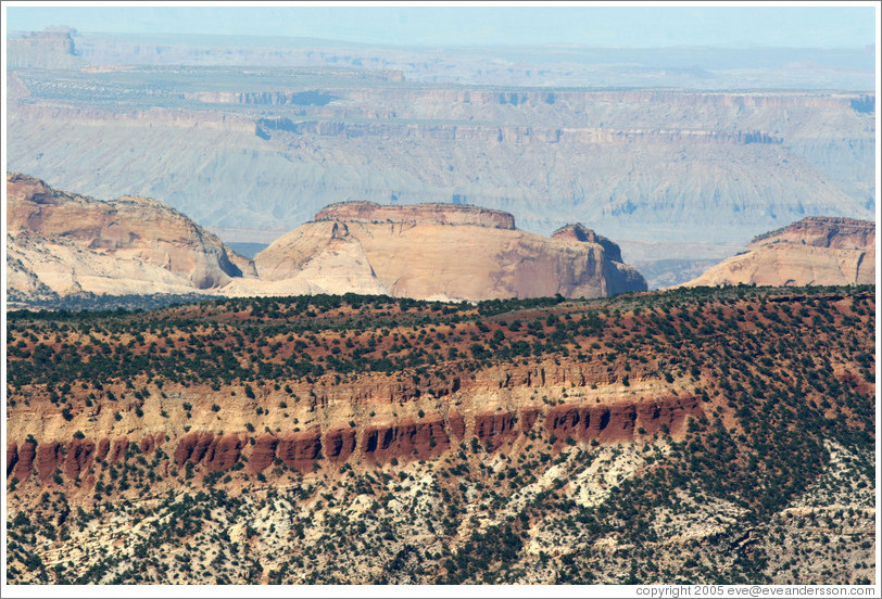
olistostromes (brownish strata in lower part of hillside) and ophiolites (dark material in upper part of section) exposed in eastern Cuba; webpages: trenches and mélanges]

Labels: , , , , , , ,

minerals

Mineral are naturally occuring homogeneous solids with definite chemical compositions and ordered atomic arrangements, and are either elements or chemical compounds that have been formed by geological processes.

◊◊ Minerals Site Map ◊◊

See also IMA Commission On New Minerals And Mineral Names:

Labels:

| 0 Guide-Glossary

monoclines

schematic of monocline A monocline is a step-like geological fold without a change in dip direction across the fold hinge because the layers dip in the same direction.

This is contrasted with anticlines, in which limbs dip away (curve downward) from the hinge, and with synclines, in which the limbs dip toward the hinge (curve upward).

(images at left - click to enlarge - top, schematic of monocline; middle, looking along the eroded strata of Waterpocket Fold in Capitol Reef National Park, mid-res, hi-res; bottom Waterpocket Fold from Strike Valley Overlook, mid-res; image below right, schematic cross section through Waterpocket Fold.)

looking along the eroded strata of Waterpocket Fold in Capitol Reef National ParkThe Waterpocket Fold in Capitol Reef National Park is a classical monocline that is almost 100-miles long (160 km). It is a huge regional fold with one very steep side in otherwise nearly horizontal layers.

schematic cross section through Waterpocket FoldDuring the Laramide Orogeny, between 50 and 70 Ma, the rock layers on the west side of the Waterpocket Fold were elevated more than 7000 feet (> 2000 m) higher than the layers on the east. The entire Colorado Plateau was subsequently uplifted again, and erosion has exposed this fold within the last 15 to 20 million years.

Waterpocket Fold from Strike Valley Overlook [links: formations: classic monocline in which Mesozoic strata dip 45º, near Mexican Hat, Utah, 2, 3; monoclinal drape fold, Shell Canyon, Bighorn mountains; Dinosaur National Park monocline; Waterpocket Fold, Capitol Reef, Utah, and eastern flank of Waterpocket Fold, 2; Waterpocket Fold area, as viewed from Boulder Mountain; Strike Valley overlook, 2; Capitol Reef, 2, 3, 4, from the Burr Trail, Chimney Rock trail, Sunset Point; Cross sections of Strike Valley of Waterpocket Fold showing formations and their topographic expression; View of tilted beds along the Waterpocket Fold; satellite: monocline and syncline crossed by transverse stream, Capitol Reef, UT, and nearby monocline and syncline; Henry Mt. laccoliths, Capitol Reef, UT; satellite image; webpages: Capitol Reef; Folding Satellite Images Set]

Labels: , , , ,

. . . evolving since 01/07/07