faulting
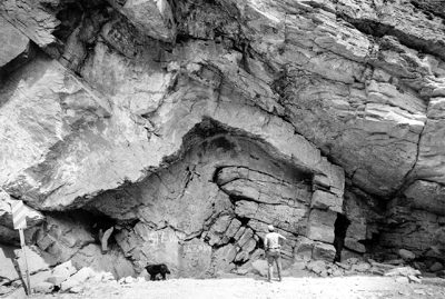
 Complex deformation with failure of strata and accompanying movement of one rock body relative to another creates geologic faults, fault lines, or simply faults. The fault zone is that area of complex deformation that is associated with the fault plane.
Whether in a normal or a reverse fault, the hanging wall is defined as the rock body above the line of the fault, while the footwall lies below the fault.
 Shear stresses that cause faulting in shear zones may be associated with tectonic compression at plate boundaries, with tectonic extension, with impact compression, or with compression by overburden.
 Stresses build in rocks where friction prevents simple slippage. Stresses initially cause deformation of rock structures, and only when accumulated potential energies exceed the strain threshold will rock bodies fail and relative motion occur across the fault.
Initially, rock failure may occur on a small scale (microfracturing, microseismicity). However, continued compression can cause the large-scale slippage associated with seismic events (tremors and earthquakes).
Relative movement (slip) determines the type of fault that occurs:
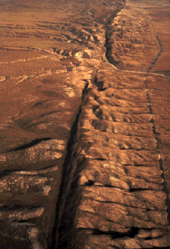
▪ strike-slip or transform faults, such as the San Andreas Fault
▪ normal
▪ reverse (thrust) faults such as the hugh Lewis Thrust
▪ normal
▪ reverse (thrust) faults such as the hugh Lewis Thrust
[link: images: animation: model of earthquake centered on Hayward Fault; small-scale faulting: small fault in Delmar formation; small fault in Mosaic Canyon, Death Valley, and recumbent folding; fault; low-angle thrust fault in moraine; moderate-scale faulting: normal fault; fault; growth fault with well developed clay smear exposed in cliff face near Albuquerque New Mexico; fault in rocks (left slid down relative to right), Mosaic Canyon, Death Valley, and limestone/marble fault breccia; Early Carboniferous quartz-cemented, mineralised fault breccia in a fault strand of the Billefjorden Fault Zone, Gråkammen, Austfjorden, Spitsbergen; breccia; fault breccia, Haughton impact structure; normal fault, 2, fault, 2, Birmingham Shale, Bakerstown Station, PA; Blue Anchor, Somerset, 2; labelled fault; Surpise Cliff Fault in Ricardo Group sediments, close-up, and aerial view of fault; fault, Black Hills; Internal Oriskany Hanging Wall Deformation; Devil's Elbow fault separates red Tertiary megabreccia (hanging wall) from strongly deformed Proterozoic gneiss in (footwall), another footwall block in right foreground, and close-up; San Gabriel Fault (where the light rock meets the dark rock); fault in complex zone of oblique thrusting on the Alpine Fault (mylonite thrust up to 2 km westwards over Quaternary gravels, NZ); fault; detachment fault; thrust fault, Melabakkar; Early Tertiary folded and thrust Permian and Carboniferous strata with Cretaceous dolerite sills; view subparallel with thrust movement, and isoclinally folded dolerite sill between two thrust faults, Midterhuken, Bellsund, Spitsbergen; early Tertiary thrust ramp (left) and box folds (right) in Triassic strata, typical foreland structures of marginal fold-thrust belts, Engadinerberget, Wedel Jarlsberg Land, Spitsbergen; synsedimentary faulting: extensional duplex or synsedimentary growth faults in the Triassic Botneheia Formation, Eistradalen, Agardhdalen, Eastern Spitsbergen; collapse of a sandstone plateau or delta front. Festnigen sandstone, base of Helvetiafjellet Formation (Barrême), and (closer) Festnigen sandstone, base of Helvetiafjellet Formation (Barrême), KvalhovdenArea, Kvalvågen, Eastern Spitsbergen; large-scale faulting: San Andreas Fault, 2, from Shuttle, topographic map, diagram, folding; Keraf Suture in Sudan Collision Zone; Lone Pine, CA; Fault line in Southern California; Alaska's Denali Fault, map, 2, Denali Fault Earthquake Fact Sheet; Fault Scarp, Rock Creek, and closer view, 2; Furnace Creek Fault; Transform Strike-Slip Faults across Atlantic Mid-Ocean Ridge; Faults and Fault Zones in Ross Sea; webpages: picture gallery of Svalbard, Jan Mayen, and Dronning Maud Land, Antarctica]
Labels: Blue Anchor, Death Valley, deformation, fault lines, faulting, Hayward Fault, Keraf Suture, San Andreas Fault
| 0 Guide-Glossary