B
▪ back-arc basin ▪ Baltica ▪ banded (ribbon) vein ▪ basalt ▪ basaltic breccia ▪ batholith ▪ blended unconformity ▪ boudin (vein) ▪ boudin, boudinage ▪ breccia ▪ bysmalith ▪
|
0 Guide-Glossary


Definitions and images to illustrate geological terms, links to images and website articles
![]()


 Back-arc basins are associated with tensional forces caused by asymmetric seafloor spreading and oceanic trench rollback at some convergent plate boundaries.
 Forearc basins are sea floor depressions located between subduction zones and their associated volcanic arc.
Labels: back-arc basin, convergent plate boundaries, extension, forearc basin, fossil back arc basin, magmatic axis, marginal basin, obduction, oceanic trench, seafloor spreading
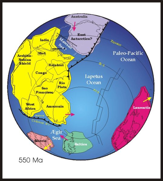 The continent of Baltica (green) existed from the Late Proterozoic to the Early Palaeozoic and included what is now the East European craton of Northwestern Eurasia. Baltica was created as an entity not earlier than 1.8 Ga. Before this time, the three segments/continents that now make up the East European craton were in different places on the globe.
Labels: Alpine orogenies, Archean, Baltic Shield, Baltica, Caledonian, Hercynian, Laurentia, Paleozoic, Precambrian, Proterozoic
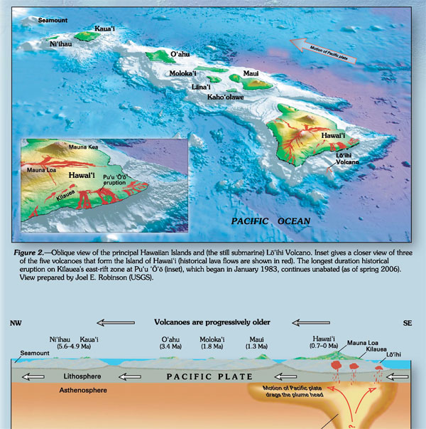
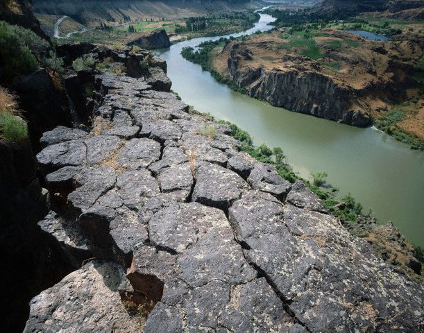
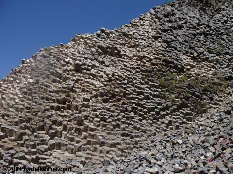
| 0 Guide-Glossary Basalt magmas form by decompression melting of peridotite in the mantle. The crustal portions of oceanic tectonic plates comprised predominantly basalt, derived from upwelling peridotite in the mantle below ocean ridges. The basalt shield volcanoes of the Hawaiian island chain sit above a mantle plume, or 'hot spot'. (left - click to enlarge - aa flows over ropey pahoehoe in Hawaii - image courtesy of USGS.)
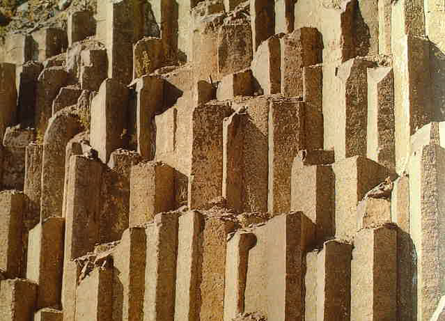
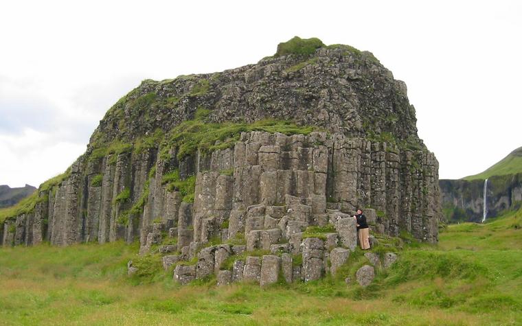
 (image left - click to enlarge - courtesy USGS - top-down: basaltic lava; lava field; flow-lines in basalt formation; close-up of vesicular basalt with olivine crystals; surface of basalt hand specimen; basalt columns.)
Labels: basalt, diabase, dolerite, gabbro, lava, ocean ridges, peridotite, porphyritic, scoria, vesicular
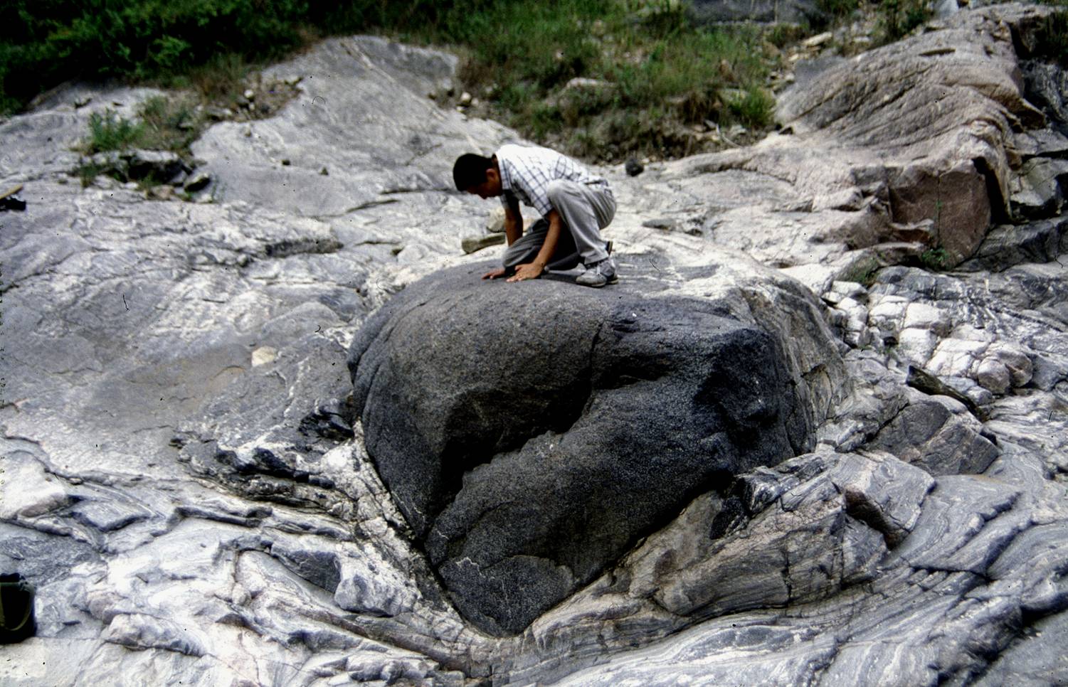
| 0 Guide-Glossary Batholiths are complex intrusive bodies composed of plutonic igneous rocks, usually of felsic or intermediate rock-types, such as granite, quartz monzonite, or diorite. Batholiths are also called granite domes.
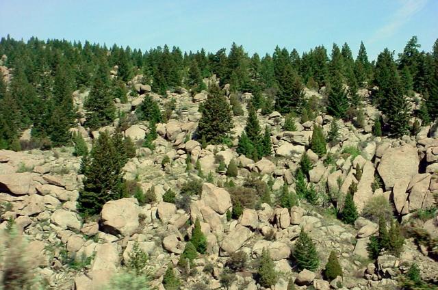
 Spheroidal weathering produces boulder fields, and sheet-like exfoliative weathering, which is accelerated by frost wedging, creates smooth structures like Half Dome in the 40,000 sq km Sierra Nevada Batholith in Yosemite (upper left, right - click to enlarge). The Coastal Plutonic Complex of British Columbia and Alaska is even larger, extending for 1,800 kilometers and covering 182,500 sq km. Other North American batholiths include the following: The Idaho Batholith is a composite mass of granitic plutons covering approximately 15,400 square miles in central Idaho [map, Castle Peak, Contact Batholith]. Guichon batholith in British Columbia contains several large, low-grade copper deposits. The South Mountain Batholith (SMB) of southwestern Nova Scotia is the largest granite batholith in the Appalachian Orogen with an approximate area of 7300 sq km.
Labels: batholith, crystalline, diapir, emplacement, exfoliative weathering, felsic, Halifax Pluton, intrusion, stock
| 0 Guide-Glossary Boudinage refers to structures deformed by extension in ductile shear zones. Boudinage structures contain a rigid tabular body that has been stretched and deformed where embedded within more deformable (less competent) rocks.
 Competent tabular bodies that are susceptible to boudinage include veins and strata such as sandstones. Where conditions favor brittle fracture rather than ductile deformation, imbricate (overlapping) fracturing occurs.
Labels: boudinage, boudins, deformation, ductile, extension, extension fractures, imbricate, shear zones
| 0 Guide-GlossaryLabels: Bowen's Reaction Series
| 0 Guide-Glossary Breccia is a are clastic, sedimentary rocks comprising angular fragments from a previous rock structure that have been cemented in a matrix.
Labels: breccia, cement, clastic, matrix, sedimentary
Labels: Black Mesa bysmalith, bysmalith, Colorado Plateau, discordant, faults, Henry Mountains Wilderness, laccolith, Utah