


syncline
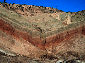
 A syncline is a concave geological fold, with layers that dip downward toward the center of the structure. This arrangement is opposite to that of an arching anticline.
Provided that the syncline has not been overturned, strata within synclines have progressively younger rock layers toward the center of the syncline, with the youngest layer at the fold's center or hinge, mirrored by the same layers in reverse sequence on the opposite side of the hinge. Elongate circular or circular fold patterns create basin structures.
 Folding typically develops during crustal deformation as the result of compression that accompanies orogenic mountain building.
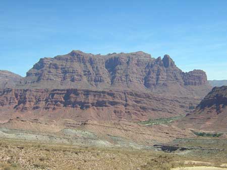
Strata folded as the Rocky Mountains formed. Near Mount Withrow in northeastern B.C., a prominent syncline is outlined by beds of sandstone that form ridges because they are resistant to weathering. A low area at the centre of the fold is underlain by shale, which weathers very readily. The syncline stretches off into the distance.
Wyoming's Powder River Basin is another notable example of synclinal folding.
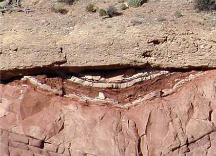
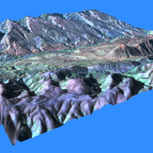
[ links: images: formations: synclinal folds outlined by ridges of resistant sandstone, Rocky Mountains near Mt. Withrow; syncline core in Miocene sandstone and shale from the western Tarim Basin, China; Syncline near Indus Suture, Tibet; syncline and unconformity; Mojave syncline that formed at a bend in a strike-slip fault in Rainbow Basin, 2, aka Barstow syncline; Mexican Hat Syncline, UT; overturned syncline in Taconic slates, VT; Scotch Hill syncline, VT; synclinal; sycline in Lockhart Basin, UT; 3D Camargo syncline in central Bolivia (3D glasses needed); Camargo syncline, 2; Camargo syncline center foreground and the San Juan de Oro surface unconformably over it in the background, view looking south with LandSat image draped over the topography; syncline exposed in Monarch Canyon in the Funeral Mountains, Death Valley; Tremont syncline in Llewellyn Formation, PA, Alleghanian Orogeny 290-250Ma; syncline and some accommodation structures near Bude, Cornwall; The Glen Lake Syncline; anticline and syncline and complicated folds near Calico Ghost Town, Yermo, California; Sideling Hill, western Washington County, Maryland Syncline; syncline in Maryland I-68 roadcut, 2, 3, 4, 5; anticline-syncline pair, Canadian Rockies; Gibson Peak syncline; tightly folded syncline that formed as a drag fold along the boundary of a thick, Miocene, andesite dike (upper left), Monterey Shale at Crescent Bay in Laguna Beach; Monument Fold, Colorado River; syncline, 2; satellite: Tindouf syncline; plunging anticlines and synclines, Dinosaur National Monument, UT; monocline and syncline; Henry Mt. laccoliths, Capitol Reef, UT; monocline and syncline crossed by transverse stream, Capitol Reef, UT; Atenango Del Rio Syncline, pseudo false color, false color composite, principle components, digital elevation model; diagram: fold types; websites: Fault Block Mountains Folded Mountains Upwarped Mountains Accreted Mountains; Geology of the Sideling Hill Road Cut; Camargo Syncline Geology]
Labels: Atenango Del Rio, Camarga, Capitol Reef, Death Valley, Henry Mt. laccoliths, Laguna Beach, Lockhart Basin, Rainbow Basin, Rocky Mountains, Sidelong Hill, synclinal fold, syncline, Tindouf