


monoclines
 A monocline is a step-like geological fold without a change in dip direction across the fold hinge because the layers dip in the same direction.
This is contrasted with anticlines, in which limbs dip away (curve downward) from the hinge, and with synclines, in which the limbs dip toward the hinge (curve upward).
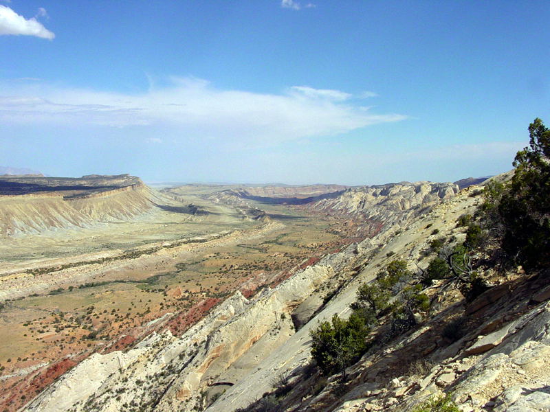
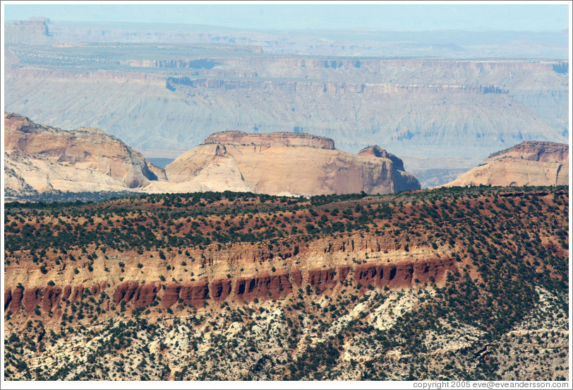
(images at left - click to enlarge - top, schematic of monocline; middle, looking along the eroded strata of Waterpocket Fold in Capitol Reef National Park, mid-res, hi-res; bottom Waterpocket Fold from Strike Valley Overlook, mid-res; image below right, schematic cross section through Waterpocket Fold.)
 The Waterpocket Fold in Capitol Reef National Park is a classical monocline that is almost 100-miles long (160 km). It is a huge regional fold with one very steep side in otherwise nearly horizontal layers.
 During the Laramide Orogeny, between 50 and 70 Ma, the rock layers on the west side of the Waterpocket Fold were elevated more than 7000 feet (> 2000 m) higher than the layers on the east. The entire Colorado Plateau was subsequently uplifted again, and erosion has exposed this fold within the last 15 to 20 million years.
 [links: formations: classic monocline in which Mesozoic strata dip 45º, near Mexican Hat, Utah, 2, 3; monoclinal drape fold, Shell Canyon, Bighorn mountains; Dinosaur National Park monocline; Waterpocket Fold, Capitol Reef, Utah, and eastern flank of Waterpocket Fold, 2; Waterpocket Fold area, as viewed from Boulder Mountain; Strike Valley overlook, 2; Capitol Reef, 2, 3, 4, from the Burr Trail, Chimney Rock trail, Sunset Point; Cross sections of Strike Valley of Waterpocket Fold showing formations and their topographic expression; View of tilted beds along the Waterpocket Fold; satellite: monocline and syncline crossed by transverse stream, Capitol Reef, UT, and nearby monocline and syncline; Henry Mt. laccoliths, Capitol Reef, UT; satellite image; webpages: Capitol Reef; Folding Satellite Images Set]
Labels: Capitol Reef National Park, monoclinal fold, monocline, Utah, Waterpocket Fold